Digital Representation and Survey Lab
The Digital Representation and Survey Lab is an interdisciplinary laboratory that acts mainly in the field of theories and methods of representation and survey for the documentation and critical reading of the archaeological, architectural and environmental heritage.
The objective of the laboratory is the definition of research themes that are cross to different scientific-disciplinary sectors, including Drawing and Archaeology, aimed at knowledge, conservation and enhancement of the archaeological and architectural heritage.
The laboratory incorporates an interdisciplinary team of archaeologists, architects, engineers, physicists and geologists.
The Digital Representation and Survey Lab is part of the the Centre of Excellence of the Cultural Technological District of Lazio – DTC LAZIO, and specifically of network 1 (Survey Laboratory and territorial information systems - SurveyLab) and network 5 (Laboratory of numerical models and 3D prints as a new frontier for museum communication - 3D printing).
Research lines
Survey
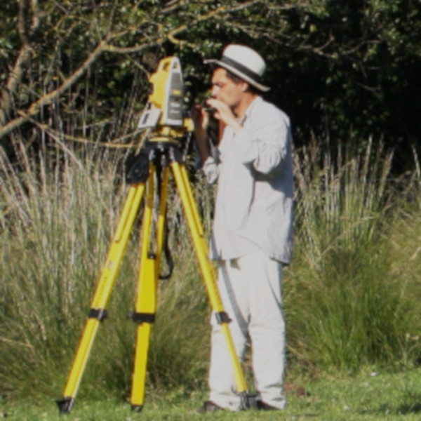
- As an instrument of knowledge, study, analysis and representation of the archaeological and architectural heritage aimed at the diachronic reconstruction of the main historical and construction phases.
- Integrating different methods and techniques, direct and instrumental (geodesics, photographic, terrestrial and aerial photogrammetry, topographic, laser scanning).
- Defining specific protocols for the restitution of metric, morphological and thematic data.
GIS, Thematic Cartography and Storymap
- Development of methods and procedures, definition of theoretical and operational tools in the context of proprietary and open source GIS systems.
- Data analysis, control, study and archiving of information through database and storymap implementation, territorial development, historical reconstruction of the survey area and understanding of settlement processes.
- Creation of tools and methods for the management and representation of data to guide territorial planning choices and create thematic (archaeological) maps, aimed at the analysis and restitution of new geographical information.
3D Printing
- Study and processing of specific 3D numerical and multi-scale models aimed at 3D printing.
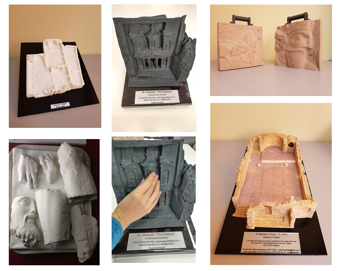
- New scenarios in the archaeological field with different fields of application: the reproduction of artifacts, the representation of the territory, the reproduction of entire archaeological areas and buildings. The advantage is not only to print the models, but also to design the print according to different objectives, thus being able to choose the detail, the materials, the representation scale and different possible levels of interaction, in order to improve the access also to categories with different disabilities. 3D prints become useful tools to operate augmented reality (AR) processes in a framework of interdisciplinary applications for the communication of results, especially in museum contexts, where the reproduction of archaeological and architectural artifacts is the basis for the understanding of important historical phenomena.
- Study and application of new technologies to improve the conditions of accessibility to cultural heritage with particular regard to the use of archaeological works and sites also by visually impaired or blind people thanks to the use of physical models and multisensory applications.
Enhancement of tangible and intangible cultural heritage
- Implementation of museum and/or territorial projects for the development of the potential of national and international cultural contexts through interventions aimed at implementing their use.
- Study for the drafting of guidelines dedicated to the promotion of sustainable tourism based on the re-discovery of the importance of the identity of places as a local and global value.
Staff Digital Representation and Survey Lab

Andrea Angelini

Diego Baldi

Gabriele Baldissara
Giovanni Caratelli
Francesca Colosi

Barbara Foschi

Pasquale Galatà
Cecilia Giorgi

Anna De Meo
Tommaso Leti Messina
Claudio Ricci
Members of the Digital Representation and Survey Lab
Roberto Gabrielli, già CNR ISPC; Raffaele Biscione, ex CNR; Marco Carpiceci, Sapienza University of Rome; Carlo Cereti, Sapienza University of Rome; Roberto Franchi, ex Università di Urbino; Eva Malinverni, Università Politecnica delle Marche; Roberto Orazi, ex CNR; Roberto Pierdicca, Università Politecnica delle Marche
How to contact us
rdrlab@ispc.cnr.it
Projects and Research activities
PRIN 2017 Le pavimentazioni stradali in pietra. Storia, Conservazione, Valorizzazione e Progetto | ISPC Rome Branch.
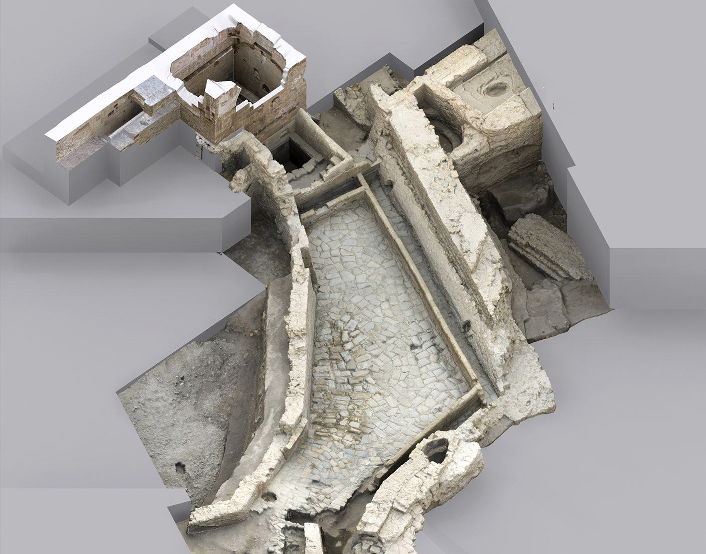
MAECI Jordan. Tecnologie Innovative e Attività di Formazione per la Conservazione e Valorizzazione del Sito Archeologico Umm er-Rasas.
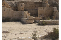
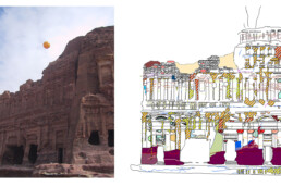
MAECI Jordan. Documentation and Conservation for Petra Archaeological Park (DaC for PAP). The Rupestrian Tombs of Petra.
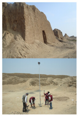
MAECI IRAN project. Archaeology and Technology in Eastern Iran
MAECI PERU project Intervento operativo per il complesso archeologico di Chan Chan: conoscenza, valorizzazione, promozione.
Progetto Isola di Capri (2020-2023). Realizzazione della carta archeologica nei Comuni di Capri e Anacapri | Unità di Ricerca ISPC.
Palazzo Doria Pamphilj project (2020-2021). Architectural survey of the Palazzo Doria Pamphilj cloister in Rome | ISPC Rome Branch.
Progetto Borbona (2020-2021): Camminando nella Storia | Unità di Ricerca ISPC.
Progetto Cori (2019-2024). Sperimentazione e applicazione di nuovi approcci metodologici e tecnologie di rilevamento nello studio del patrimonio archeologico e monumentale della città di Cori.
Progetto Pendici nord orientali del Palatino. Terme di Elagabalo (2019-2022). Un sistema integrato per la gestione, la consultazione e la rielaborazione della documentazione di scavo.
Progetto bilaterale internazionale CNR-CONCYTEC 2021-2022 | Piano per la gestione del rischio di eventi dannosi a Chan Chan (Trujillo, Perù): analisi multidisciplinare e metodologia HBIM.
For further information on ISPC research activities click the button.
Main collaborations
Universities
- ELTE University of Budapest – Department of Biological Anthropology
- Sapienza Università di Roma (Dipartimento di Scienze dell’Antichità – Dipartimento di Disegno, Storia e Restauro dell’Architettura – Pianificazione, Design, Tecnologia dell’Architettura)
- The University of Vermont, College of Art & Sciences
- Universidad de Lima (Perù)
- Universidad Privada Antenor Orrego (Trujillo, Perù)
- Università degli Studi di Enna Kore
- Università Politecnica delle Marche
Archaeological Superintendences
- Soprintendenza Archeologia Belle Arti e Paesaggio per l’Area Metropolitana di Roma e per la Provincia di Rieti
- Soprintendenza Archeologia Belle Arti e Paesaggio per l’Area Metropolitana di Napoli
Museums
- Museo della Città e del Territorio di Cori
Istitutions
- Comune di Anacapri (NA)
- Comune di Borbona (RI)
- Comune di Capri (NA)
- Comune di Cori (LT)
- Comune di Suelli (SU)
- Fondazione Varrone Cassa di Risparmio di Rieti
- ICAR (Iranian Center for Archaeological Research)
- Istituto di Cultura Italiana al Cairo
- Istituto Italiano di Cultura a Lima
- Jordan Department of Antiquities
- Ministerio de Cultura del Perù
- Ministero degli Affari Esteri e della Cooperazione Internazionale (MAECI)
- Natural History Museum of Budapest – Department of Anthropology
- Proyecto especial complejo arqueológico Chan Chan
- RICHT (Research Institute of Cultural Heritage and Tourism)
Companies
- Facto 3D
- Gexcel
Main publications
A. Angelini, Tecniche di rilevamento e metodi di rappresentazione per l’Architettura Rupestre, BAR International Series, Oxford 2018.
A. Angelini, R. Gabrielli, Laser scanning e photoscanning. Tecniche di rilevamento per la documentazione di beni architettonici ed archeologici, «Archeologia e Calcolatori», 24, All’insegna del Giglio, Firenze 2013, pp. 379-394.
C. Bacigalupo, A. De Meo, T. Leti Messina, Il rilievo topografico e fotogrammetrico nell’area del Forte di Sant’Andrea Claudio Grenzi, Foggia (Italia), in Approcci multidisciplinari per la ricostruzione del paesaggio di una grande strada romana. La via Appia al valico degli Aurunci, 2019, pp. 80-90.
C. Bacigalupo, A. De Meo , T. Leti Messina, Integrazione di tecniche di rilievo e informatiche per lo studio e la messa appunto di un GIS archeologico per Sabratha, in Pagani e cristiani a Sabratha e Leptis Magna tra III e VI secolo d.C. Monumenti e reperti, tradizione e immagini, Agrigento, 2012, 175-184.
G. Caratelli, C. Giorgi, The photogrammetric survey of the mosaics, in Alessandri C. (ed.), The Restoration of the Nativity Church in Bethlehem, CRC Press – Taylor & Francis Group, London 2020, pp. 216-223.
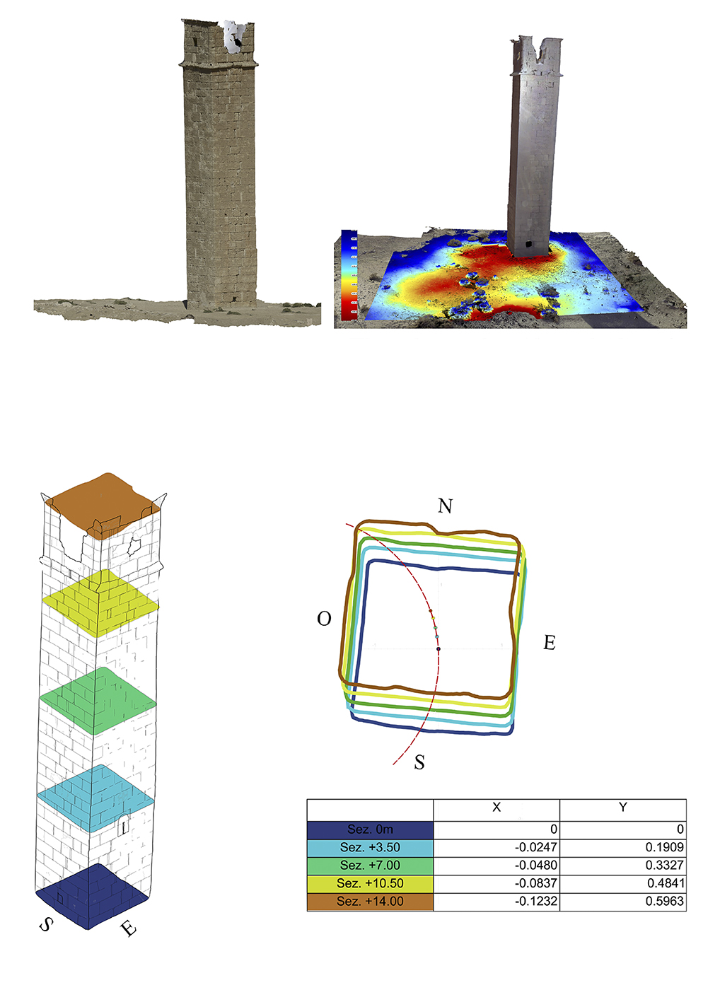
M. Cozzolino, R. Gabrielli, P. Galata, V. Gentile, G. Greco, E. Scopinaro, Combined use of 3D metric surveys and non-invasive geophysical surveys at the Stylite Tower (UMM AR-RASAS, JORDAN), Annals of geophysics 2019, 62 (3), SE339, pp.1-9.
A. Felicetti, A. Albiero, R. Gabrielli, R. Pierdicca, M. Paolanti, P. Zingaretti, E. S. Malinverni, Automatic Mosaic Digitalization: A Deep Learning approach to tessera segmentation. 2018 Metrology for Archaeology and Cultural Heritage (MetroArchaeo), 2018, pp. 132-136.
C. Giorgi, G. Caratelli, Verso una nuova carta archeologica per l’isola di Capri. Il contributo del CNR al progetto Masgaba, in Archeologie Borboniche. La ricerca sull’antico a Capri e nelle province di Napoli e Terra di Lavoro. Convegno internazionale di Studi (Capri – Anacapri, 11-12 ottobre 2019), Quasar 2020, pp. 21-41.
E.S. Malinverni, R. Pierdicca, F. Colosi, R. Orazi, Dissemination in archaeology: a GIS-based StoryMap for Chan Chan, Journal of Cultural Heritage Management and Sustainable Development, Vol. 9, No. 4, 2019, pp. 500-519.
R. Pierdicca, E.S. Malinverni, E. Frontoni, F. Colosi, R. Orazi, 3D visualization tools to explore ancient architetectures in South America, Virtual Archaeology Review, 7, 15, 2016, 44-53.