Archaeological Mapping for Preventive Archaeology and Planning Policies
A study on ancient cities with continuity of living and territories aimed at promoting the integration between conservation and sustainable development of urban and rural landscapes
PNRR M4C2: PRIN 2022
Acronym: ArchMAPP
Description
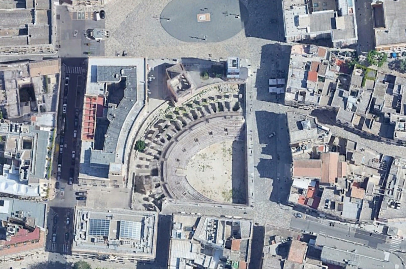
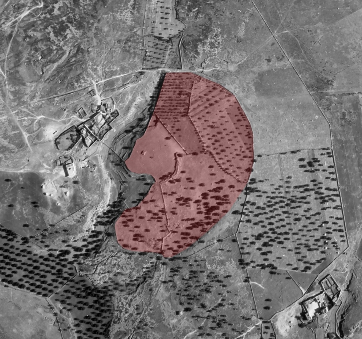
The project proposes research activities on four case studies in southern Italy: two cities with a long continuity of occupation Brindisi/Brundisium and Lecce/Lupiae, and on two abandoned settlements in rural areas that are particularly at risk Masseria Vicentino/Mesochorum and St. Eleuterio/Aequum Tuticum.
The goal is to develop digital archaeological maps integrated into GIS as tools immediately available for Archaeological Superintendence and Local Administrations during heritage protection works. Furthermore, these tools could help in defining of suitable urban and territorial planning policies that consider the archaeological and landscape values.
Project information
- Funded by: European Union NextGenerationEU and Italian Ministry of University and Research
- Call: PNRR: Missione 4 – Componente 2 “Dalla ricerca all’impresa” – Investimento 1.1 – Progetti di Ricerca di Rilevante Interesse Nazionale (PRIN)
- Start date: 2023
- End date: 28 February 2026
- ISPC Scientific coordinator: Giuseppe Scardozzi
- Project Leader: CNR ISPC
- Partners: Università del Salento
- Budget: € 224.973 (CNR ISPC: € 114.973)
News & Eventi
CONVEGNO FINALE
Cartografia archeologica per l’archeologia preventiva e le politiche di pianificazione
Studi sulle città antiche a continuità di vita e i territori finalizzati a promuovere l’integrazione tra conservazione e sviluppo sostenibile dei paesaggi urbani e rurali
27 febbraio 2026 | H 09:00 – 17:00
Lecce, Università del Salento, Edificio Donato Valli, Aula 9
Il convegno presenta i risultati finali del progetto PRIN ArchMapp, dedicato allo sviluppo della cartografia archeologica come strumento per l’archeologia preventiva, la pianificazione territoriale e la tutela dei paesaggi urbani e rurali. L’incontro riunisce ricercatori dell’Università del Salento e del CNR ISPC per discutere metodologie innovative di remote e proximal sensing, analisi dei dati e nuovi studi su città antiche a continuità di vita. Attraverso casi di studio che spaziano dall’Irpinia a Brindisi e Lecce, il convegno approfondisce l’integrazione tra ricerca archeologica, conservazione e sviluppo sostenibile.